Cruising around the world on an aluminum catamaran.
Friday, August 13, 2010
day 14 – Koskimo Islands to Bunsby Islands (Lo50°05.5’L127°33.0’)
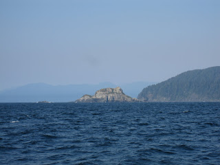
Another 04:30 wake-up call, another return to bed at 04:50. There was still a gale warning in effect, but the winds were predicted to diminish. This is a good sign, but not quite good enough to lift anchor just yet. Back to bed, then back up for a lazy breakfast and to listen to the next weather forecast at 10:30. Finally! The wind warnings were over! 15-25 knot winds, diminishing, and 1-2 meter waves, sun shining. Good enough for us, let’s go!! Today’s journey was a long one – overall it was calm, but as soon as we hit that swell again I could feel it in my centre. It took about an hour to get from our anchorage to the swell, then about 4 hours to the western-most point of Brook’s Peninsula, Cape Cook and Solander Island. But once we rounded that corner, and resumed surfing with the southeast flowing current instead of jumping diagonally across it, I could feel the sea-sensitivity in my core instantly numb to comfort. I could even read my book a little bit. Another 2 hours to the south tip, Clerke point, then we rounded that corner and entered into Checlecet Bay. From there it was much smoother – the swell was behind us, winds were calm. We continued until the Bunsby Islands, at the mouth of Ououkinsh Inlet and Malksope Inlet. Anchor down in a small bay beside Small Bunsby. It feels and looks at a little different – we are no longer on the North Island, we are now Central Island. The wind is a bit warmer, the water a little smoother. I don’t know if it’s the geography, or the weather system, or a little of both, but it feels like August again!
Subscribe to:
Post Comments (Atom)
Archive
-
▼
2010
(54)
-
▼
August
(33)
- day 2 - Thormanby Island to Copeland Islands (Lo50...
- Maps of our journey so far...
- day 3 - Copeland Islands to Cortes Island (Lo50°00...
- day 4 – Cortes to Cordero Channel (Lo50°26.7’L125°...
- day 5 – Cordero Channel to Turnour Island (Lo50°35...
- day 6 – Turnour Island to Cormorant Channel Marine...
- pictures from Turnour Island
- day 7 - Cormorant Channel Marine Park to Hope Isla...
- day 8 – Hope Island to Sea Otter Cove (Lo50°40.7’L...
- day 9 – Sea Otter Cove to Quatsino Sound, Browning...
- day 10 – Browning Inlet to Winter Harbour (Lo50°31...
- day 11 – Winter Harbour to the mouth of Quatsino S...
- day 12 – Winter Harbour to Koskimo Islands (Lo50°2...
- day 13 – Koskimo Islands
- day 14 – Koskimo Islands to Bunsby Islands (Lo50°0...
- day 15 – Bunsby Islands to Rugged Point (Lo49°58.4...
- day 16 – Rugged Point to Zeballos (Lo49°58.5N’L126...
- day 17 – Zeballos to Friendly Cove (Lo49°35.7N’L12...
- day 18 AM – Yuquot & Friendly Cove, Nootka Island
- day 18 PM – Friendly Cove to Hot Springs Cove (Lo4...
- day 19 – Maquinna Provincial Park (Hot Springs Cove)
- day 20 – Hot Springs Cove to Young Bay, Sydney Inl...
- day 21 – Young Bay to Bacchante Bay (Lo49°26.5N’L1...
- day 22 – Baccante Bay to Meares Island (Lo49°09.6N...
- day 23 – Meares Island to Tofino (Lo49°09.2N’L125°...
- day 24 – Tofino to Effingham Bay (Lo48°52.7N’L125°...
- day 25 – Effingham Bay to Nettle Island (Lo48°55.7...
- day 26 – Nettle Island to Bamfield (Lo48°49.5N’L12...
- day 27 – Bamfield to Port San Juan – Thrasher Cove...
- day 28 & day 29 – Port Renfrew (Lo48°33.4N’L124°25...
- day 30 – Port Renfrew to Sooke (Lo48°21.0N’L123°43...
- day 31 – Sooke to Victoria (Lo48°24.7N’L123°27.8’W)
- day 32 – Victoria
-
▼
August
(33)
No comments:
Post a Comment